

The Sierra Nevada | Find Your Extraordinary
Part 4 - The Sierra Nevada
If Highway 1 is the road everyone should travel at least once, Highway 395 is a close second. In less than 100 miles, you’ll journey from one of the lowest points in the western hemisphere to the tallest peaks in the country.
Lodging - Whether you’re camping under the stars, staying in a mountain cabin, or checking into a 5-star resort in Mammoth or Tahoe—your adventure can be as rugged or as refined as you’d like.

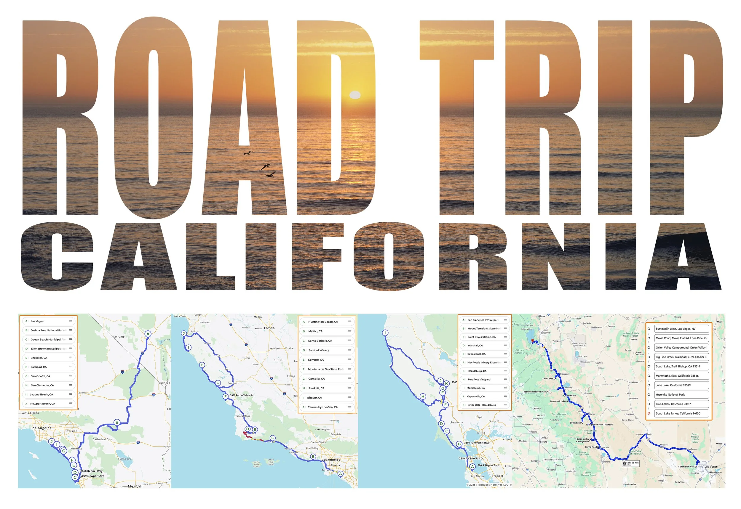
Destination : Vegas to Tahoe Via HWY 395
Miles: 621 (From Vegas)
Days Needed: 4-6 Days
Best Time of Year: August - Early Oct (No Mosquitos)
Adventure Factor 1-5: 4-5
Hidden Gems: Alabama Hills, Lake Sabrina / South Lake, Silver Lake, Tioga Pass, Conway Summit, Edgewood Tahoe
Bonus Stops : Mesquite Sand Dunes (Death Valley), Schat's Bakery (Bishop),
Shortcut - Not Really an Option
Death Valley National Park (Stop 1)
The Hottest and Driest Location on Earth.
Drive north(ish) from Vegas to Beatty, stop for gas and a snack at the Death Valley Nut and Candy Store and the real adventure begins as we head west to the Sierras via Death Valley.

Heat Waves The Mesquite Flat Sand Dunes shift daily under desert winds, sitting just 90 miles from Mt. Whitney, the highest peak in the Lower 48.
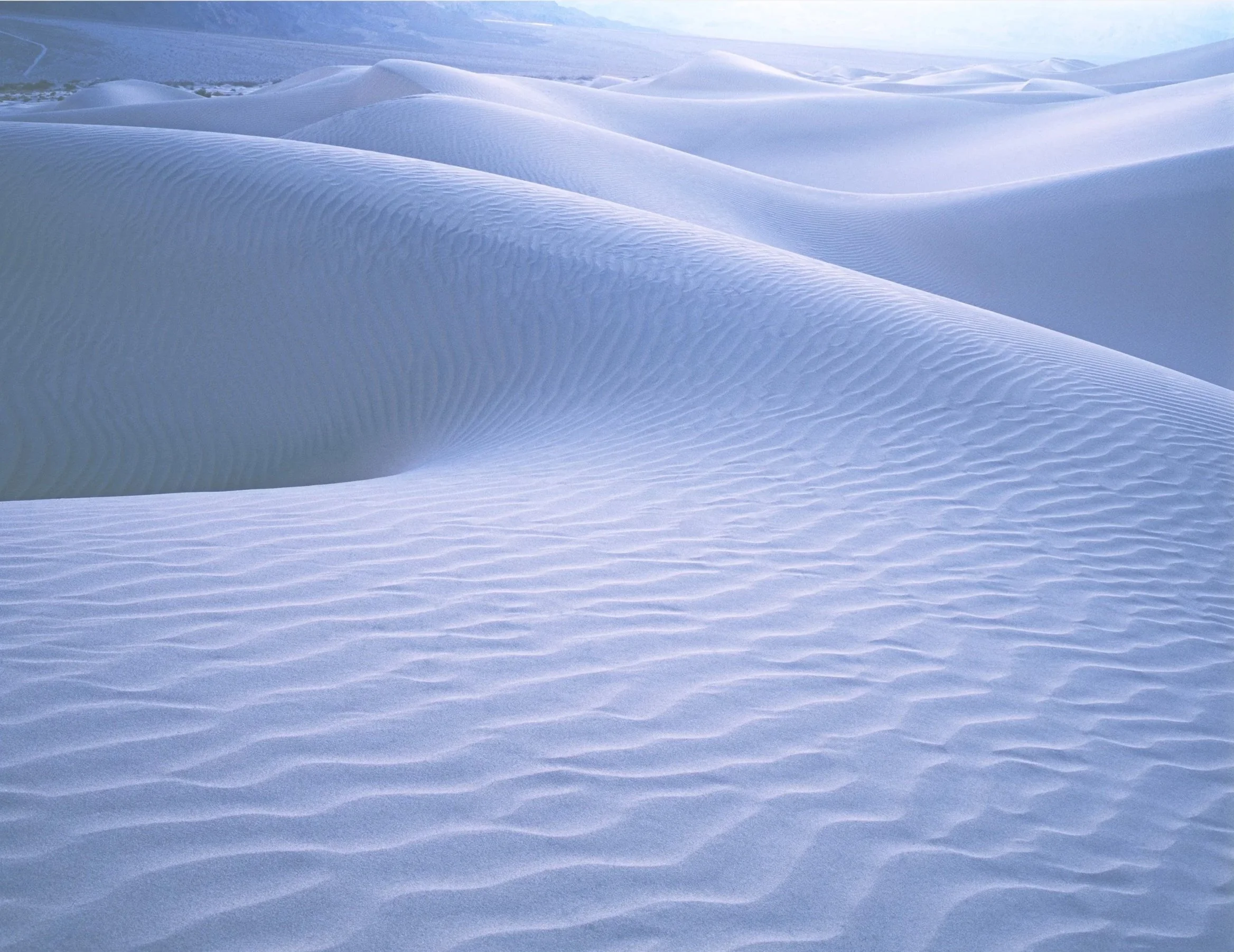
Moonlit Dunes Visit by moonlight for an otherworldly experience.

Somewhere in Death Valley
Alabama Hills (Stop 2)
The Shadow of the Most High
Hollywood’s favorite backdrop, framed beneath Mt. Whitney, the tallest peak in the Lower 48. Don’t miss sunrise through the Mobius Arch for a view you’ll never forget.
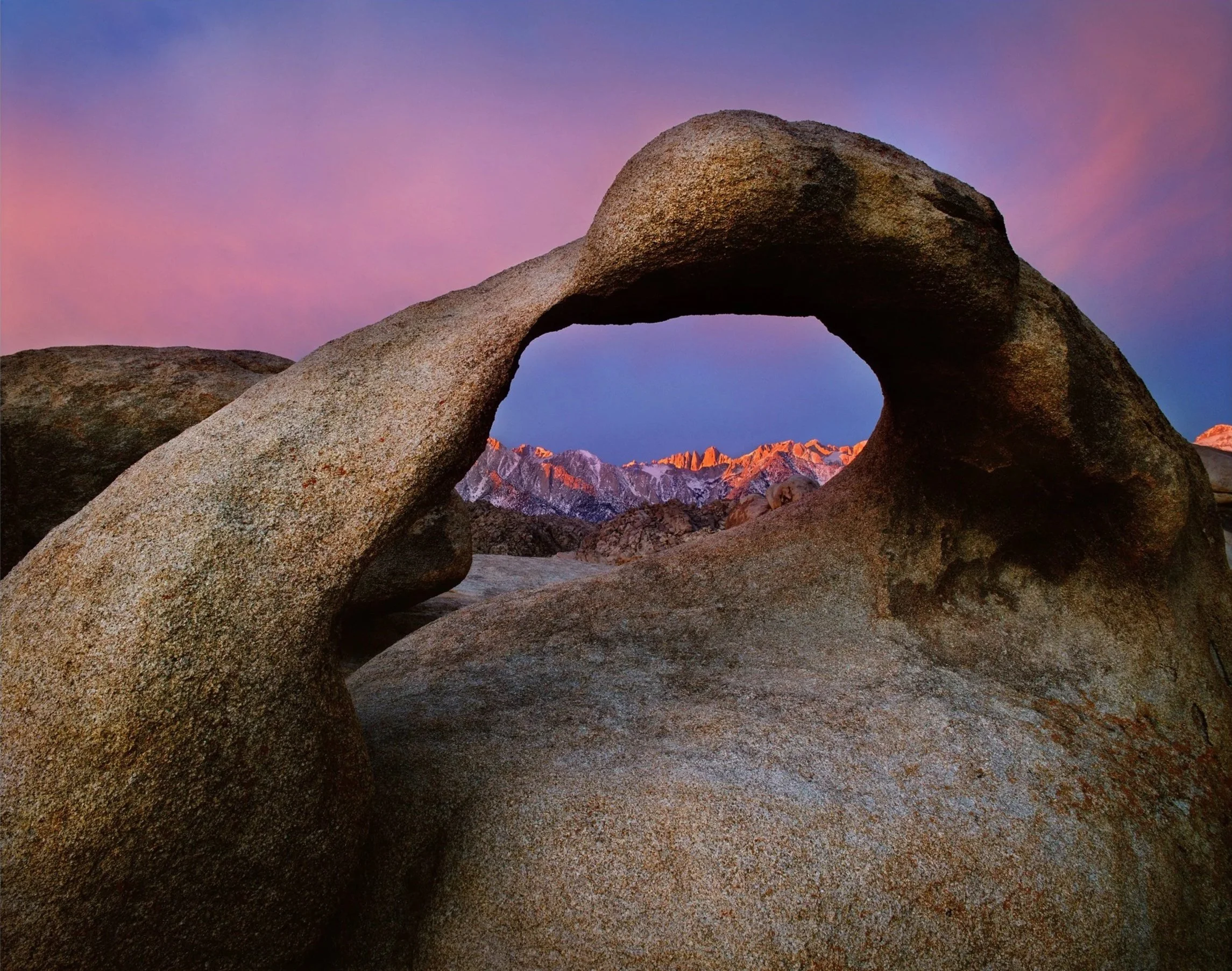
Sierra Sunrise First light shines on Mt. Whitney as a winter storm clears, viewed through the Mobius Arch in the Alabama Hills
Onion Valley Trailhead (Stop 3)
Your First High Sierra Experience
Moving north we take a left turn at Independence and drive up to the Onion Valley Trailhead. At 10,000 feet, waterfalls and alpine lakes lead to Kearsarge Pass (11 Mile Round Trip). From here, you’ll gaze into Kings Canyon National Park from above.
Kearsarge Sunrise First light paints the Kearsarge Pinnacles in Kings Canyon National Park.

Clinging to Winter Looking out over the frozen Kearsarge Lakes on a late may afternoon in Kings Canyon National Park.

There and Back Again Looking west into Kings Canyon National Park from Kearsarge Pass
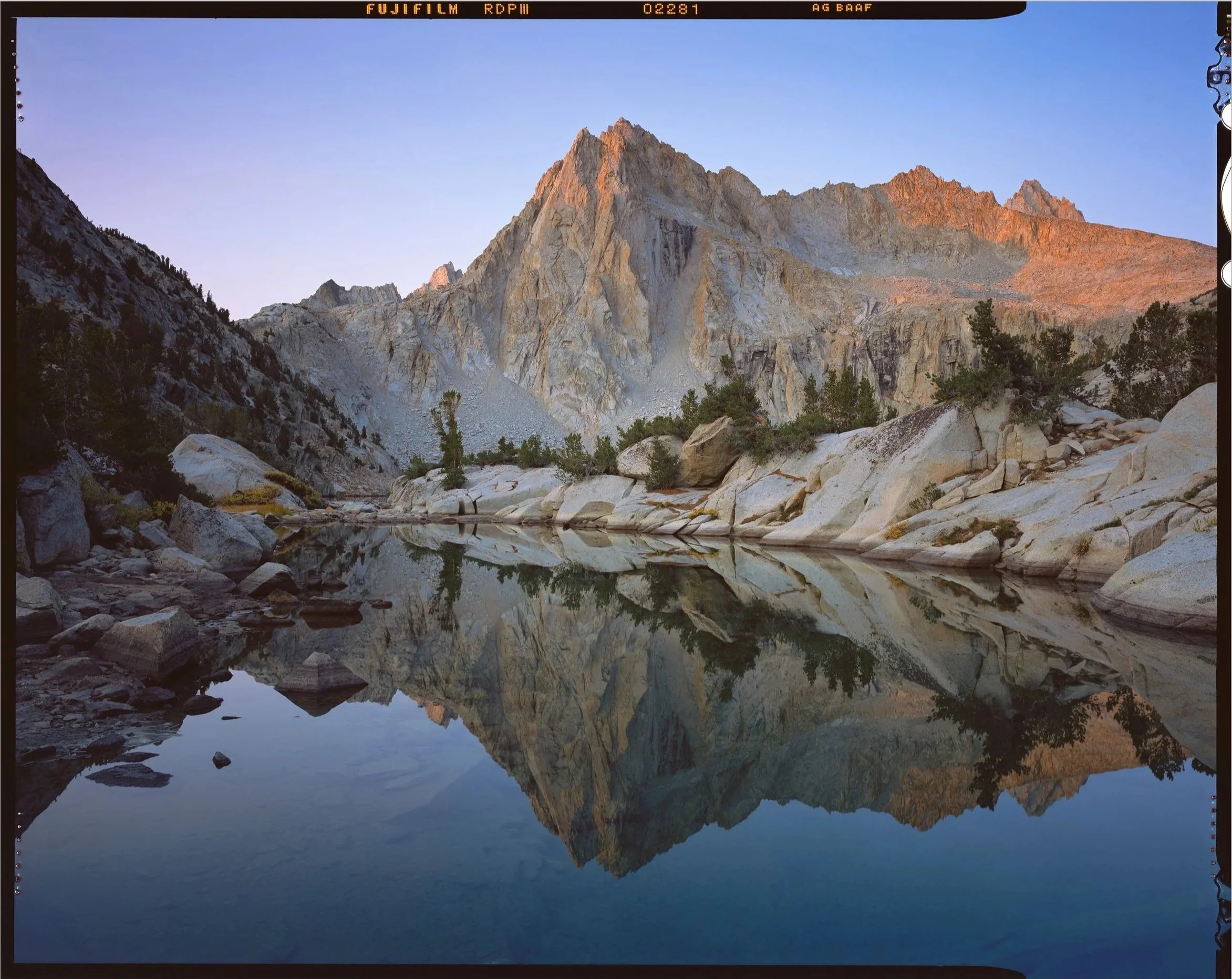
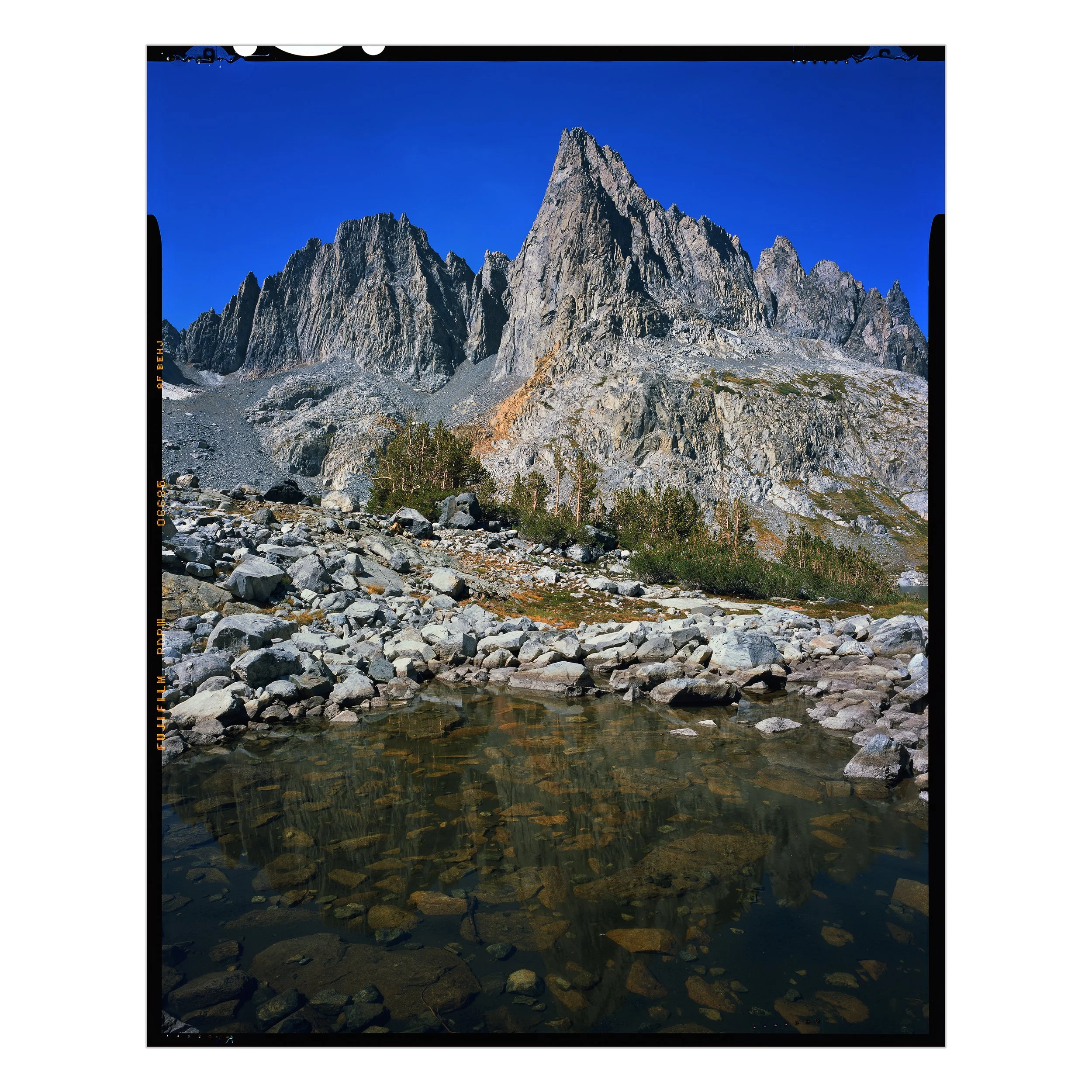
Big Pine Creek Trailhead (Stop 4)
Glacier Lakes and Palisades
Our next stop is the Big Pine Creek Recreation Area, a wonderland of turquoise glacier-fed lakes beneath the Temple Crag. Fairytale landscapes, short approaches, and starlit campsites.

Alpine Emerald Evening light outlines the Temple Crag and the distant Thunderbolt and North Palisade Peaks looming above Second Lake (10-mile round trip).

Eisley (our daughter) watching the stars emerge above the High Sierra from our campsite overlooking Second Lake in mid-July after the all-time record snow year in 2023.
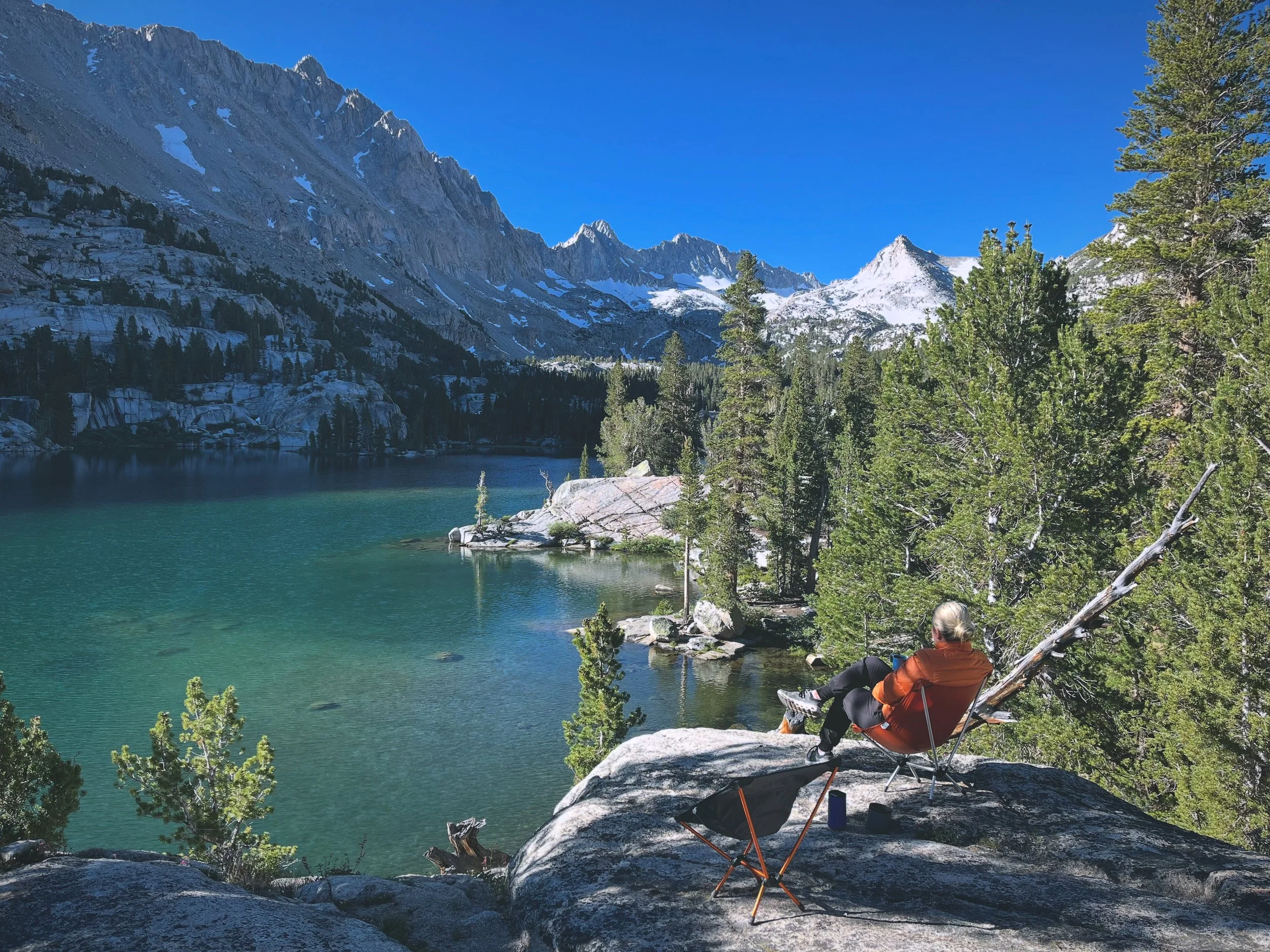
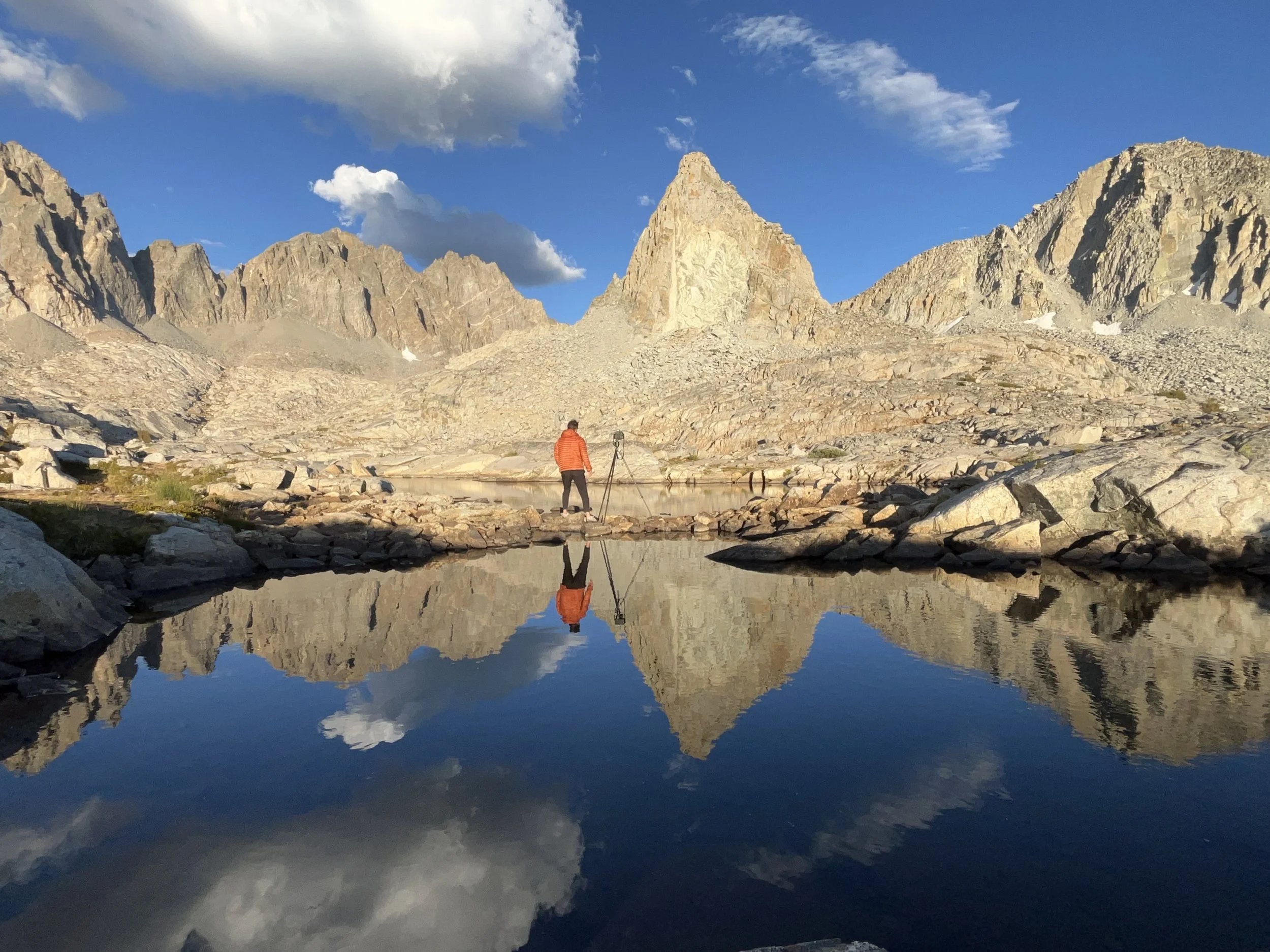
Lake Sabrina / South Lake (Stop 5 + 6)
The Heart of the Sierra Nevada
If you only choose one trailhead, make it here. Endless options for day hikes and overnight treks, with some of the most iconic views in the range.
Searching for Symmetry Picture Peak and the distant Mount Haeckel reflect in Hungry Packer Lake (15 Miles Round Trip) as first light shines in the upper reaches of Sabrina Basin.
Haley (my wife) enjoying coffee from our campsite on Blue Lake, perhaps the best bang for your buck location in the Sierra Nevada (6 Mile Round Trip)
The upper lakes of Dusy Basin, (20-mile round trip from South Lake Trailhead) Isosceles Peak, Thunderbolt, and North Palisade Peaks reflect in an outlet as the sun begins to set.

Dusy Basin Lower Lakes (18.5-Mile round trip from South Lake Trailhead) at sunset in mid August
Mammoth to June / Silver Lake (Stop 7 + 8)
California's Quintessential Mountain Town
Brewpubs, boutique stays, and trailheads into the Minarets—the jagged spires of the Central Sierra. Mammoth is a great destination in and of itself or as a home base for day trekking or overnighting amongst some of the most dramatic peaks in the Sierra Nevada.
Sierra Secrets Clyde Minaret reflects in a pool above Lake Cecile on the High Sierra Trail.

Descending from Iceberg Lake to Ediza Lake on the High Sierra Trail

Garnet in Gold Evening light shines through wildfire smoke above Garnet Lake with Mt. Ritter and Banner Peak towering above the landscape in the distance.

Ediza Sunrise Sunrise and the Minaret Range reflect on the surface of Lake Ediza.
Yosemite + Bridgeport To Tahoe (Stop 9 - 11)
Granite Meets Autumn Gold
Take the scenic route via Tioga Pass into Yosemite’s high country, (and of course the iconic Yosemite Valley if you’re willing to brave the crowds of late summer) then backtrack to cross Conway Summit for an epic fall color display (late September). Finish in Tahoe with alpine sunsets, quiet mornings, and a well-earned rest at Edgewood.

Blu and a distant Half Dome on the way home from Sonoma County taking the scenic route over Tioga Pass.

Peaks & Valleys The iconic Tunnel View of Yosemite Valley as a winter storm arrives in the Sierra Nevada

Heart of Tahoe Ripples radiate from a submerged boulder on a calm and foggy morning near Incline Village, Nevada.
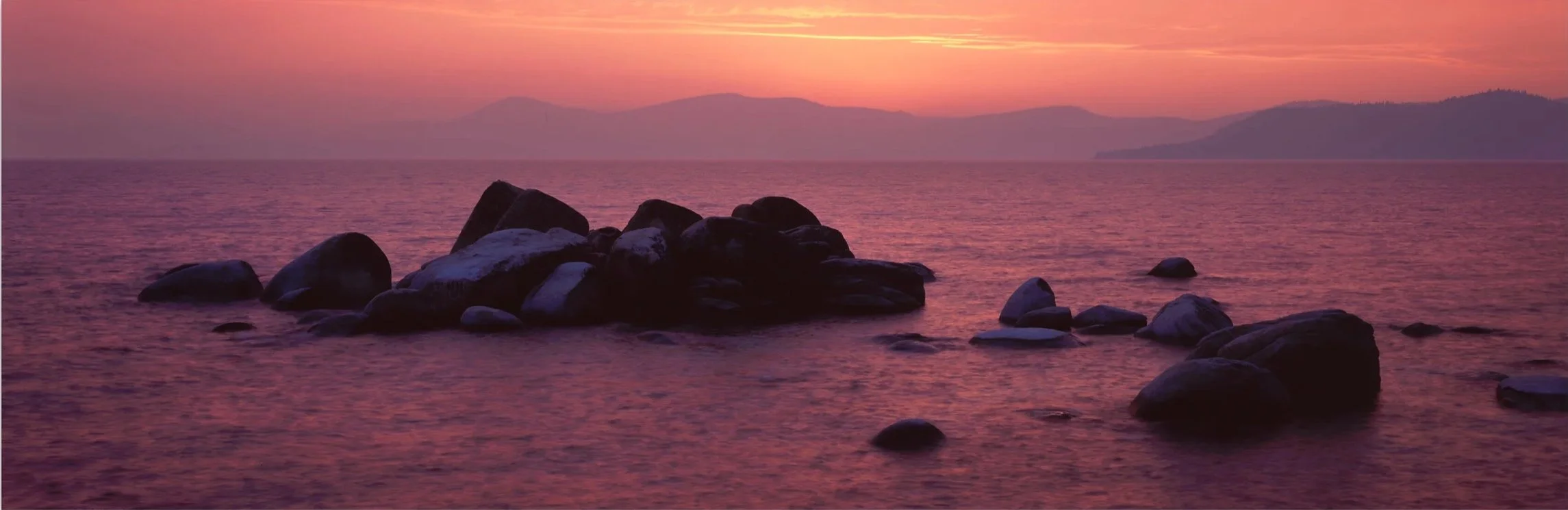
Sand Harbor Sunset An Ethereal glow reflects on the water near Sand Harbor, Lake Tahoe.

Bonsai Dusk settles over Bonsai Rock near Incline Village, Lake Tahoe.
Thank you for joining the journey. May these images and stories inspire you to step out, embrace the unknown, and find your extraordinary. Live Inspired.
Bobby Wheat Gallery | Downtown Summerlin
1825 Festival Plaza Dr. Suite 160
Las Vegas, NV 89135
United States
T: 702.569.7080